Pokemon Go's Mapping Legacy Powers New GPS-Denied Drone Tech
Niantic Spatial, spun off from Pokemon Go's $3.5B sale to Scopely, is fusing crowd-mapped models with Vantor's software for jammed-GPS drone navigation.

Spc. Annie M. Riley, Pennsylvania Army National Guard, via DVIDS, Public Domain
Niantic Spatial, the geospatial-AI company spun out of Pokemon Go’s original developer after that game’s $3.5 billion sale to a Saudi-backed publisher, is fusing a positioning model trained partly on Pokemon Go players’ location scans with defense contractor Vantor’s aerial navigation software, aiming to keep drones, ground vehicles and AR-equipped soldiers oriented when GPS signals are jammed or spoofed. Both companies confirm the underlying training data traces back to roughly 30 billion location scans Pokemon Go players contributed since 2016, and both explicitly deny that any of that raw player data was itself handed over to Vantor, a distinction that turns out to matter a great deal to what is actually true here.
A game, a spinoff, and a defense contractor
The chain of events starts with money. In March 2025, Niantic agreed to sell its entire games division, including Pokemon Go, Monster Hunter Now and Pikmin Bloom, to Scopely for $3.5 billion, with an additional $350 million pushing the total deal value to roughly $3.85 billion for Niantic’s equity holders. Scopely is majority-owned by Savvy Games Group, itself a subsidiary of Saudi Arabia’s sovereign Public Investment Fund, which had already acquired Scopely outright for $4.9 billion in 2023.
Niantic did not sell everything. Founder and CEO John Hanke spun the company’s geospatial AI business into a new, separately capitalized entity called Niantic Spatial, seeded with $250 million, $200 million from Niantic’s own balance sheet and $50 million from Scopely. What Niantic Spatial kept was not the games themselves but the AI models those games had helped build: a system for recognizing real-world locations from camera images, developed in large part because millions of Pokemon Go players spent nearly a decade scanning public landmarks, statues and fountains to unlock in-game rewards called PokeStops.
In December 2025, Niantic Spatial announced it was partnering with Vantor, the space-and-defense intelligence firm formerly known as Maxar Intelligence, to combine that ground-level model with Vantor’s own aerial positioning software for military and government customers.
What the partnership actually does
The technical pitch is straightforward. Niantic Spatial’s Visual Positioning System (VPS) determines a device’s location by matching a live camera feed against a pre-built 3D model of the surrounding area, a form of visual landmark recognition rather than satellite triangulation. Vantor’s Raptor software, launched in February 2025, performs the equivalent function for aircraft, aligning a drone’s downward-facing camera against Vantor’s own proprietary terrain data. Fused together, the two systems create what both companies describe as a shared coordinate system that autonomous drones, ground vehicles, augmented-reality headsets and dismounted personnel can all reference simultaneously, even when GPS is degraded.
“Our Large Geospatial Model gives these systems the ability to perceive, align, and operate in a shared frame of reference, even when traditional GPS is unavailable,” Niantic Spatial Chief Technology Officer Brian McClendon said in the December announcement. Vantor Chief Product Officer Peter Wilczynski framed the payoff in operational terms, saying the fused system delivers “continuous operations” and “a decisive advantage in the field.”
Early testing cited by both companies reported up to a 70 percent reduction in positioning error, with accuracy in many test scenarios landing around 1.5 meters, figures that are self-reported by the partners rather than independently verified, and which the companies say formal field testing beginning in early 2026 is meant to validate. The target vulnerability is explicit: both firms name GPS “unavailability, spoofing, interference, and jamming” as the problem the joint system is built to solve.

Two separate Vantor-Army stories, often told as one
A second, unrelated Vantor development has become tangled up with the Niantic Spatial story in some coverage, worth untangling here. In February 2026, the U.S. Army awarded Vantor a contract worth up to $217 million, structured as an Other Transaction Agreement with a base year and four option years, to support the One World Terrain program. That program, as Vantor describes it, is “a cornerstone of the Army’s Synthetic Training Environment, providing realistic, automatically generated global geospatial datasets for simulation-based collective training, mission rehearsal, and mission execution.” Susanne Hake, Vantor’s executive vice president for U.S. government business, said the team is “delivering high-precision, immersive 3D terrain that enhances the Army’s ability to train, rehearse, and execute missions with confidence anywhere in the world,” per trade-press coverage of the award; no Army official was named or quoted in either Vantor’s own release or that independent reporting.
That contract funds training and simulation terrain data, not the live GPS-denied positioning capability Niantic Spatial and Vantor are building together. The two efforts share a contractor and a customer, the U.S. Army, but nothing in either company’s public materials ties the $217 million award to the Niantic Spatial partnership specifically. It is accurate to say Vantor is simultaneously deepening its role as an Army geospatial-data contractor on one track and building a Pokemon-Go-derived positioning capability for GPS-denied operations on another; it is not accurate, based on what’s publicly documented, to say the Army paid $217 million for Pokemon Go data.
What the denial actually covers
The Pokemon Go connection became a public controversy in June 2026, when outlets including Kotaku and Dexerto reported that the December 2025 Niantic Spatial-Vantor partnership was built on technology trained using Pokemon Go’s crowd-sourced location scans, three-dimensional imagery of public spaces gathered as players scanned PokeStops and gyms for nearly a decade. Both companies pushed back.
“While we have an agreement with Vantor, announced last December, it is still in its very early stages, and sharing this data is not part of the agreement,” a Niantic Spatial spokesperson told Kotaku (June 11, 2026).
Niantic Spatial also told reporters that, now that Pokemon Go itself belongs to Scopely, the game’s data is not shared with Niantic Spatial at all going forward. Read closely, though, the company’s own explanation confirms rather than refutes the historical link: it says the Pokemon Go scans “served as one component” in training its real-world foundation models, and that “the models are the product of that training, not a copy of or a means of accessing the underlying scans.” In other words, the denial is specifically that raw scan files were transferred to Vantor, a narrower claim than “this technology has nothing to do with Pokemon Go.” The model Vantor is now integrating into a defense positioning system was, by Niantic Spatial’s own account, built in part on data collected from a mobile game that gave its players no reason to expect their movements around public landmarks would one day underpin military drone navigation.
The underlying vulnerability driving all of this is not hypothetical. GPS jamming and spoofing have become a routine feature of the Russia-Ukraine war and of Middle East conflicts WeaponSpecs has covered extensively, forcing small tactical drones and loitering munitions, including systems like AeroVironment’s Switchblade 300 and Switchblade 600, to rely on GPS guidance that adversaries can degrade at relatively low cost. A visual-positioning backup that works without satellites addresses a real and growing operational gap. Whether that backup should be built on a foundation model trained on a mobile game’s crowd-sourced scans, gathered from millions of players who signed up to catch cartoon monsters, is a separate question this story does not resolve, but one that both companies’ careful, narrowly worded denials suggest they would rather not have asked too closely.
Sources
- Pokemon GO maker Niantic is selling its games division to Scopely for $3.5B — TechCrunch, Mar 12, 2025
- Niantic Spatial and Vantor Partner to Deliver Unified Air-to-Ground Positioning in GPS-Denied Areas — Niantic Spatial, Dec 16, 2025
- Niantic Spatial and Vantor Partner on GPS-Denied Positioning — Vantor, Dec 16, 2025
- Vantor Awarded Contract Worth up to $217M to Power Immersive Global 3D Terrain for U.S. Army Training and Mission Rehearsal — Vantor, Feb 25, 2026
- Vantor Secures $217M Army Contract for One World Terrain Support — GovConWire, Feb 26, 2026
- Pokemon Go Data Wasn't Shared With Drone Company, Niantic Spatial Says — Kotaku, Jun 11, 2026
- Niantic denies Pokemon Go data is being used to train military drones — Dexerto, Jun 11, 2026
Systems mentioned
Every system named in this story, with its photo and, where available, a video. Tap a card to open the full spec sheet.
Compare these side by side →
UAV / drone
Switchblade 300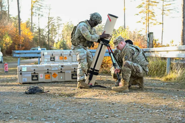
UAV / drone
Switchblade 600Frequently asked questions
Was Pokemon Go player data literally handed over to the US Army? +
No, and both companies have explicitly denied it. What Niantic Spatial licenses to defense partner Vantor is a trained AI model, its Visual Positioning System, not the roughly 30 billion raw location scans that Pokemon Go players contributed between 2016 and 2025. Niantic Spatial has acknowledged those scans were used to help train earlier versions of that model, but says the model itself, not a copy of or access to the underlying scans, is what gets shared.
What does Vantor's $217 million Army contract actually pay for? +
That February 2026 award funds the Army's One World Terrain program, which builds synthetic 3D terrain data for training simulations, mission rehearsal and the Synthetic Training Environment, not the GPS-denied positioning system Vantor is separately building with Niantic Spatial. The two are different Vantor-Army-adjacent efforts that news coverage of the Pokemon Go story sometimes conflates into one; there is no public evidence the $217 million contract itself involves Niantic Spatial's technology.
How is a Visual Positioning System different from GPS? +
GPS calculates position from satellite signals, which can be jammed, spoofed or simply blocked by terrain. A Visual Positioning System instead matches a live camera feed against a pre-built 3D model of an area, essentially recognizing where you are by what you see, the way a person navigates a familiar city without checking a map. Niantic Spatial's version handles ground-level positioning; Vantor's Raptor software does the equivalent for aircraft and drones looking downward, and the December 2025 partnership fuses the two into one shared coordinate system.
Why does GPS-denied positioning matter for drones specifically? +
Small tactical drones and loitering munitions, the kind WeaponSpecs tracks across hundreds of active-duty systems, generally rely on GPS for guidance and return-to-base navigation, a dependency that adversaries in Ukraine and the Middle East have shown can be jammed or spoofed at relatively low cost. A visual-alignment backup that works when satellite signals fail addresses a vulnerability that has already changed how drone warfare is fought in at least one active conflict.
More news


